Adaptable, Virtual Airport Layout Information At Your Fingertips
Mosaic offers affordable GIS data for airports, in XML and KML formats with consistent levels of detail across airports, licensed for use within your organization’s software and commercial products.
We do the work of keeping the data current. Mosaic updates the airport layout data monthly, to reflect recent construction and changes at the airports, based on changes in the FAA’s bi-monthly Digital – Terminal Procedures Publication (d-TPP) and other sources.
Mosaic’s Digital Airport Layout subscription service is a cost-effective solution that provides current and consistent digital layouts, currently for over 40 airports, in standardized formats that can easily be integrated into your software applications or used for aviation data analyses where the location of an aircraft in relation to a defined airport feature is required.
Accelerate the development of software applications that display aircraft locations on the surface of an airport and avoid tracking changes from frequent airport construction. Subscribe to one or all our currently supported airports or request a new airport.
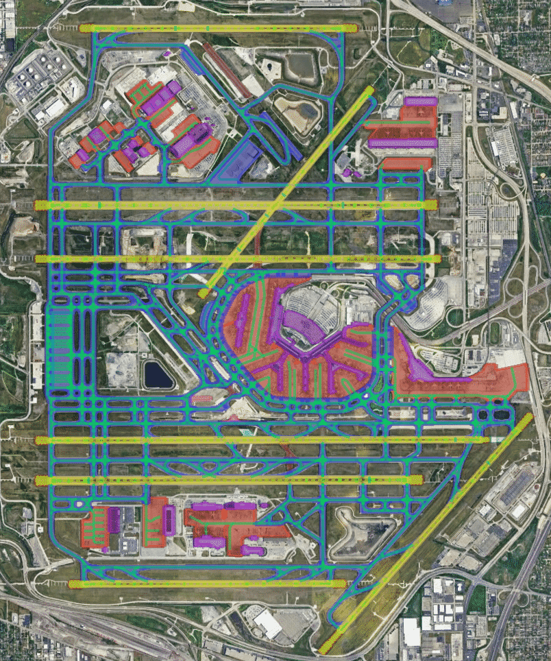
How It Works
On a monthly basis, subscribers receive airport layout files in consistent XML and KML formats. For each airport, the file defines various surface features, including:
- Aprons
- Blast Pads
- Closed Areas (where applicable)
- Construction Areas (where applicable)
- Deicing Areas (where applicable)
- Runways
- Runway Marking Lines
- Runway Marking Polygons
- Taxiway Guidance Lines
- Taxiway Holding Positions
- Taxiway Intersection Markings
- Taxiway Segments
- Airport Buildings
We package this information and send it to you monthly (10 days before d-TPP changes become operationally valid) so your application is constantly up-to-date with the latest airport changes.