Modeling & Simulation
Mosaic ATM designs and deploys aviation modeling and simulation to meet basic research needs, mature algorithms, and concepts, enable human factors research, and support federal procurement activities. Mosaic ATM’s resume is full of aviation modeling and simulation accomplishments. Foremost among these is the development of our Modeling and Simulation Environment (MSE), a robust, highly scalable “gate-to-gate” solution for modeling all phases of National Airspace System operations, from the surface and terminal departure operations, through the en-route environment, to descent and surface arrival operations.
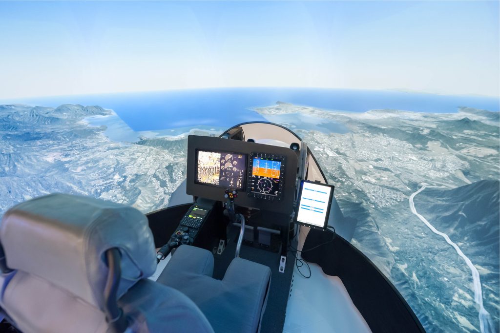
MSE provides a flexible simulation and 3D visualization platform for analyzing historical and present-day operations and studying new ATM technologies and procedures. MSE allows the researcher to scope the simulation to the study’s requirements, which may be focused on an airport surface, terminal airspace, a particular metroplex region – including all of the airport surfaces, an en-route airspace region, or the entire National Airspace System.
MSE has been adapted for multiple airports and has been successfully applied to evaluate concepts of operations, conduct performance assessments, and develop performance requirement specifications. MSE has been used to inform investment decision-making in the NextGen era. Specifically, MSE has been applied to assess Trajectory Based Operations performance, determine benefits and define requirements for the Management by Trajectory concept, define and validate performance requirements for TFDM, model benefits for TBFM, and evaluate the integration of UAS into the NAS.

While primarily intended for fast-time simulation, MSE has also been used for real-time experiments with subject matter experts interacting with the MSE display. MSE also provides simulation infrastructure components that allow researchers to set up experiments and process results. Simulation results are visualized through 2D and 3D map displays, which show TRACON video maps, NFDC data such as airways and procedures, geographic boundaries, and airport surface features for reference. Synchronized playback of multiple simulations in side-by-side windows allows visual comparisons.
Introducing DIVINED: Enabling Image-Based Geolocation
The intricacies of image-based geolocation make it a notoriously difficult task, encompassing complex factors that hinder its accuracy and scope. Despite advancements in deep learning over the years, achieving optimal results remains a struggle, sparking the debate over whether image-based geolocation is even solvable.
This is the problem that Mosaic ATM has taken on with our Deep Image Vector Imputation for Nearest Element Discover (DIVINED) geolocation engine. Developed as part of an NGA research project, DIVINED is a geographic indexer, geolocation engine, and graphical user interface. Using deep learning, Mosaic ATM has advanced the state-of-the-art on image-based geolocation, opening the possibility of geolocating the position of a ground-based photograph with all the metadata stripped from the image.
Benefits include:
- Extensive metrics collection and post-analysis tools enable researchers to capture all relevant data and interpret the simulation results.
- Specialized metrics are easily added due to MSE’s modular architecture.
- Customized graphs and tables comparing simulation runs can be generated automatically.
- Random variability and uncertainty can be injected into a wide range of simulation models.
- Monte Carlo experiments generate statistical results across large numbers of runs.
- XML files permit easy configuration of simulation cases, and batch capabilities permit large experiments to be run in the cloud unattended.
Beyond MSE, Mosaic has experience in many fast-time simulation environments developed by FAA, NASA, and DOT and our staff have applied them to various problems, including stochastic evaluation of new concepts, benefits analysis, concept development, and system-wide impact studies.
Projects

Operational Performance Assessment of Trajectory Based Operations:
MSE used to estimate recoverable benefits from total TBO benefits pool in all phases of flight (departure, climb, en route, descent, and arrival).

Management by Trajectory (MBT) Concept of Operations Development:
MSE used to develop and simulate the use of MBT when constrained by current or soon-to-be-implemented technologies. Modeled trajectory scenarios used to determine MBT benefits and define safety and performance requirements.

Terminal Flight Data Manager (TFDM) Performance Requirements Specification and Validation:
MSE used to test TFDM metering and Tactical Departure Scheduling, through thousands of Monte-Carlo demand and capacity variations measuring queue management accuracy, missed departure opportunities, etc.

Airborne Execution of Flow Strategies (AEFS) Proof-of-Concept:
MSE used for fast-time simulation activities increased the number of sensitivity runs/analyses completed by TBFM Lab Exercises. MSE included AEFS functions unable to be included in Lab Exercises and supported cost-effective concept evaluation of AEFS for inclusion in the operational TBFM system.

Time-Based Flow Management Support and NextGen Analysis:
MSE used to model the benefits of tactical Metering During Reroute Operations (MDRO). Analysis explicitly focused on the use of MSE to quantify benefits associated with reduced rerouting and continued time-based metering efficiency.