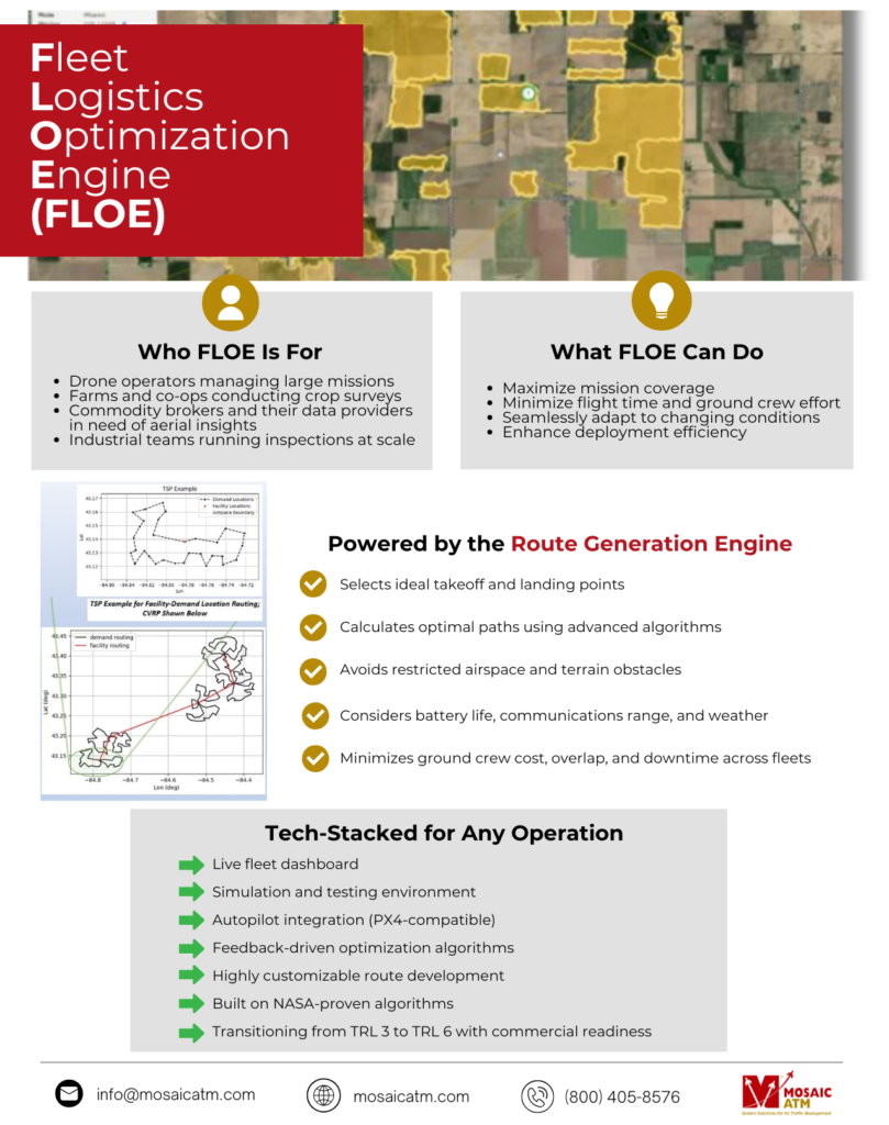
Fleet Logistics Optimization Engine (FLOE)
Powered by Aerial Vantage
Optimize Drone Operations at Scale with Our Industry-Disrupting Tool
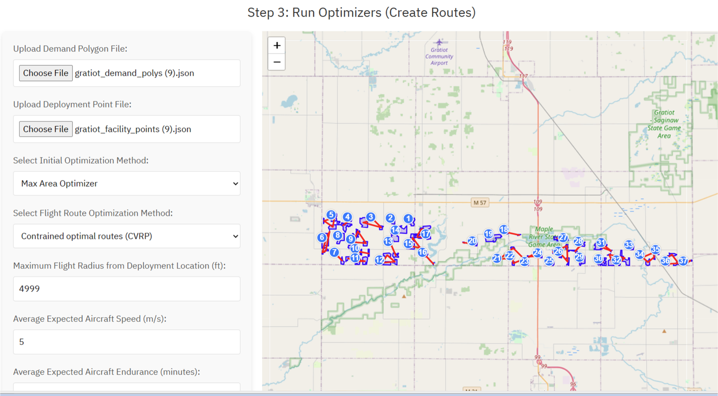
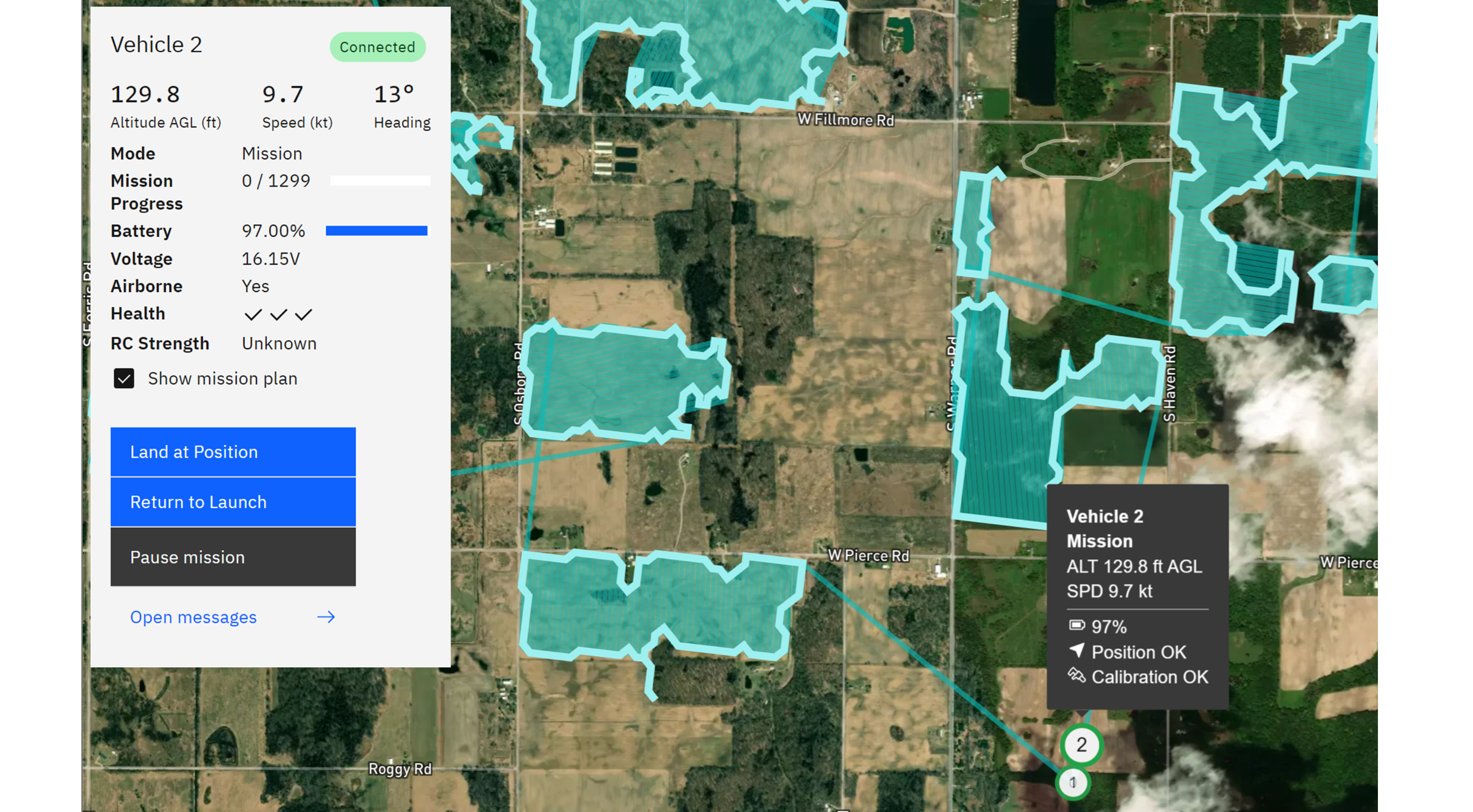
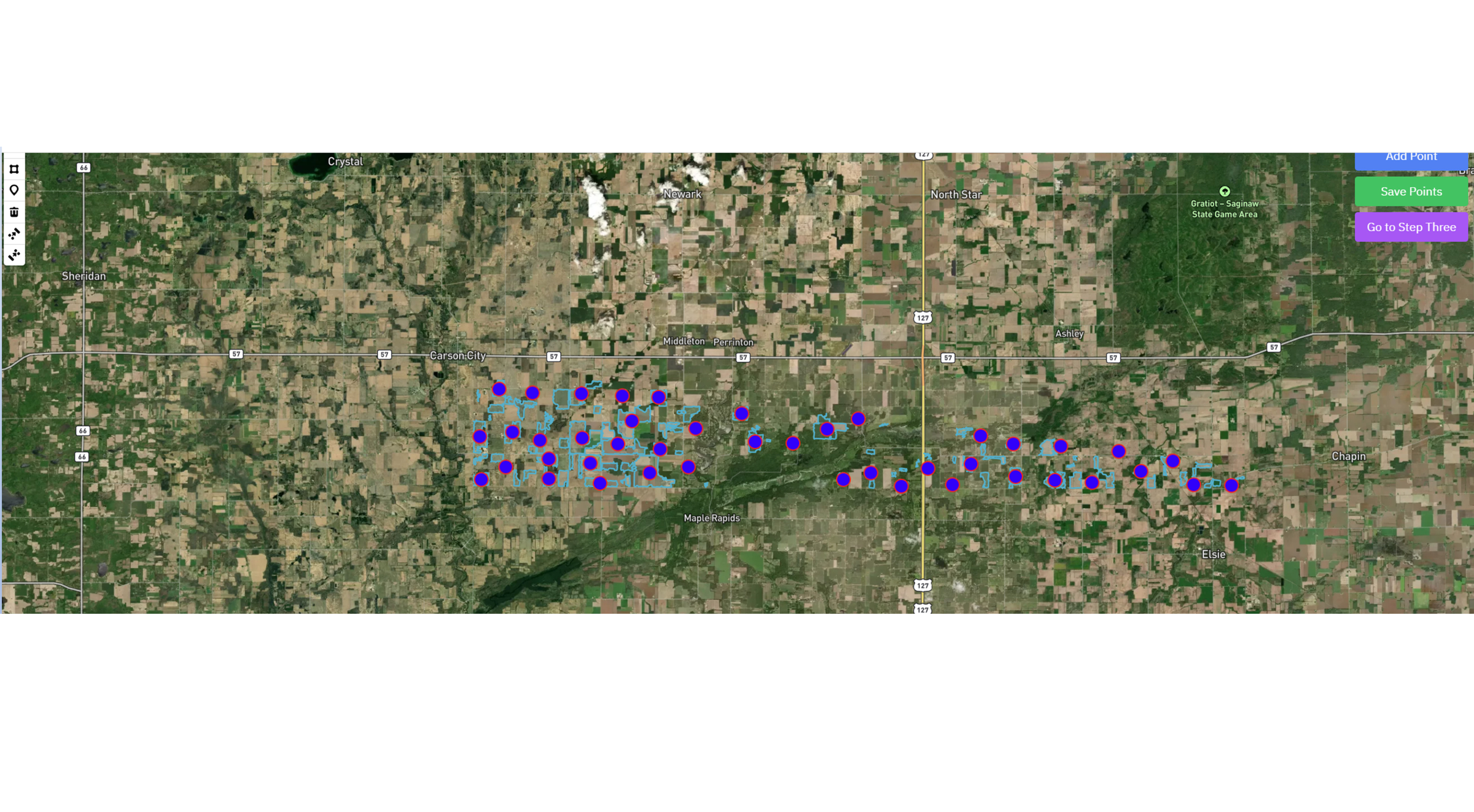
Aerial Vantage’s Fleet Logistics Optimization Engine (FLOE) brings a powerful ground control, simulation test suite, mission planner, and layered backend optimization methodology to turn mission chaos into route clarity.
Whether surveying farmland, inspecting infrastructure, or managing commodity data, FLOE helps you easily plan, optimize, and execute multi-drone operations. Our tool incorporates real-time data, advanced simulation tools, commonly used autopilot interfaces, and refined feedback systems while optimizing processes.
Built for the Field. Ready for the Future.
Modern aerial missions demand more than flight—they demand intelligence. Originally developed from NASA-funded UA-FFOpt research, FLOE is a next-generation mission planner and route optimizer that transforms how you deploy uncrewed aircraft and ground crews over vast and variable terrain or in smaller, local regions.

Who FLOE Is For
What FLOE Can Do
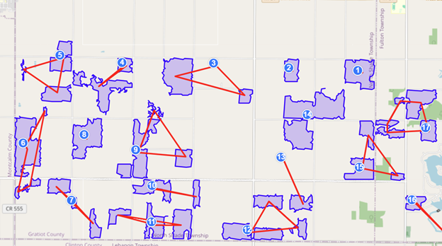
Smarter Routes, Better Results
FLOE’s Route Generation Engine creates mission plans that balance environmental, technical, and logistical constraints—so your drones fly farther, faster, and smarter.
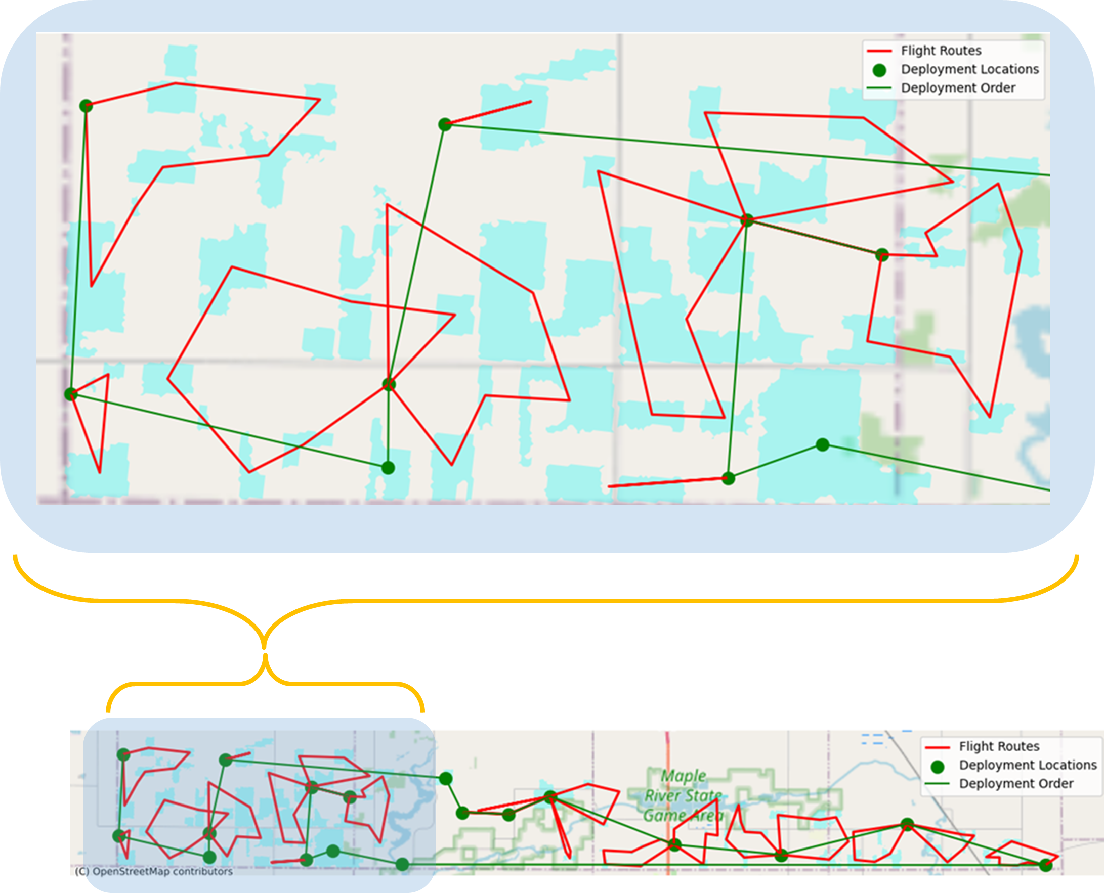
Here’s how the Route Optimization Engine can benefit your operations:
- Selects ideal takeoff and landing points
- Calculates optimal paths using advanced algorithms
- Avoids restricted airspace and terrain obstacles
- Considers battery life, communications range, and weather
- Minimizes ground crew cost, overlap, and downtime across fleets
Industries That Benefit From FLOE

Agriculture
Efficient crop surveys, early crop-type prediction, and dynamic weather adaptation.

Security and Defense Operations
Coordinate surveillance, perimeter monitoring, and tactical drone missions with real-time routing and adaptive mission control.

Farm Co-Ops
Shared fleet management, multi-client scheduling, and cost reduction.
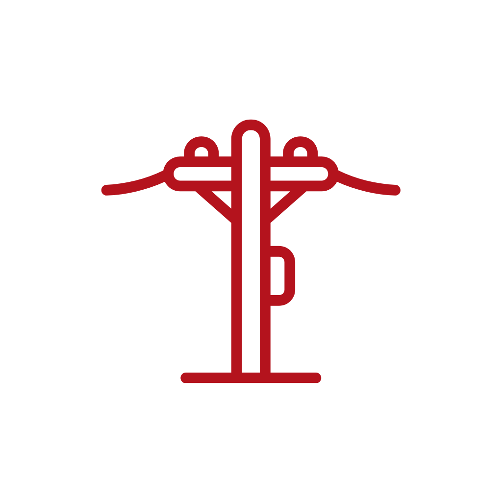
Industrial Asset Inspections
Streamlined inspections of power lines, pipelines, solar farms, and infrastructure.

Environmental Monitoring
Adaptive surveys of forests, wetlands, and sensitive regions.

Disaster Response
Rapid deployment, priority routing, and large-area damage assessments.
Tech-Stacked for Any Operation
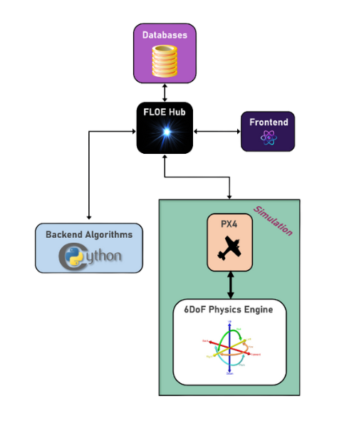
Whether you’re running one drone or a hundred, FLOE has the tools to help.
Looking Ahead: The Future of Uncrewed Operations
From rural cargo delivery to environmental monitoring and advanced air mobility, FLOE is engineered to grow with you. Its modular architecture supports:
- Real-time Unmanned Aircraft System Traffic Management feeds
- Predictive anomaly detection
- Fleet-scale scheduling, from 1-2 team operators to large-scale drone operations
Unlock the full potential of your aerial missions. FLOE isn’t just a planner—it’s your next co-pilot. Try our tool today.